The Bruce Trail Reference Maps & Trail Guide is the definitive resource for exploring the Bruce Trail and your key to a safe and enjoyable trip.
(Edition 30, published June 2020)
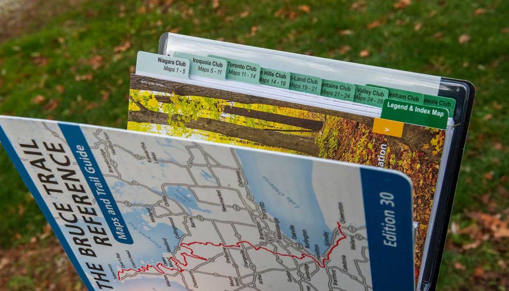
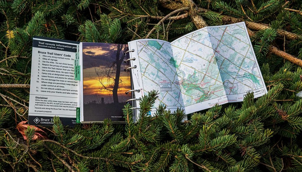
– 42 topographic maps of the Bruce Trail from Queenston to Tobermory (including Parking and access points, Camping locations).
– Trail descriptions, kilometre-by-kilometre, for the main Bruce Trail and Side Trails
– Index Map of the entire Bruce Trail
– Introductory sections on the Bruce Trail Conservancy, Niagara Escarpment geology, flora and fauna, Indigenous Culture, Trail Safety, Map Information, and more.
– Field Guide to Niagara Escarpment Species (laminated fold-out)
NEW: Indigenous Cultural Landmarks (identified in partnership with Plenty Canada)
Buy The Bruce trail reference HERE
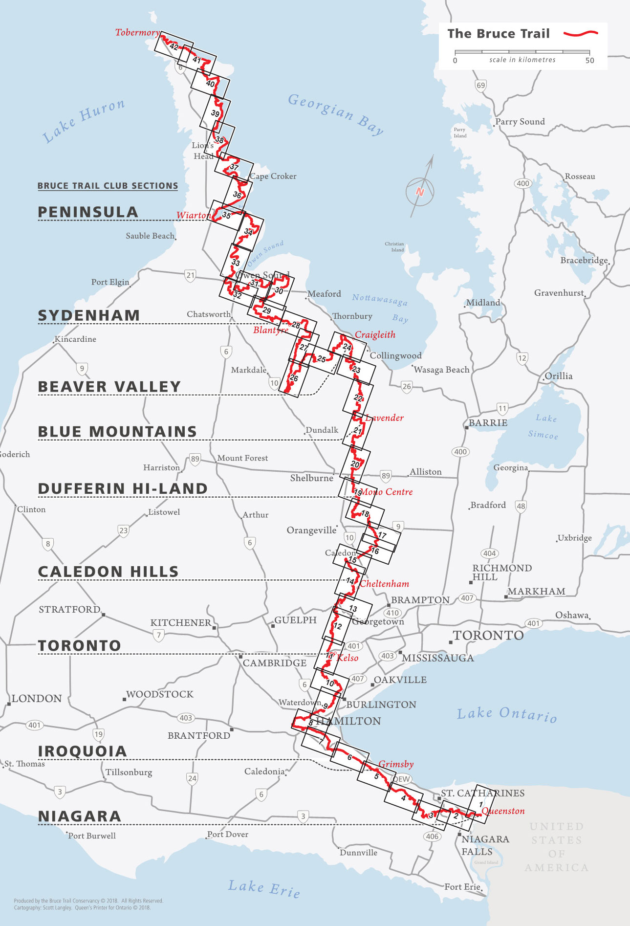
The Bruce Trail 890 km. Canada’s oldest and longest marked footpath.